
Florida Street Directory Walkthrough
A street search links several record types in sequence. It does not reveal a complete list of current occupants. First confirm the county and normalize the address, including direction and street type. Then use the county Property Appraiser to find a parcel card, the county GIS map to inspect nearby parcels, and the Clerk's official-records index to follow recorded transfers. A voter lookup can check one person at a time. A reverse directory can add an address-to-name clue for a year in which that book was published.
Keep the parcel identifier and legal description as you move between systems. Street names, postal cities, ZIP labels, and county lines can change or fail to match the same land. The address workflow is most reliable when each step records what the source actually says: assessed owner, deed party, registered voter, or named address in a dated directory. Those roles are not interchangeable.
- Use Florida DOR PointMatch to check the house number, street components, city, ZIP, and jurisdiction.
- Open the matching county Property Appraiser record and note the parcel ID, situs, mailing address, and legal description.
- Use the county GIS viewer to identify parcels along the street and save the parcel IDs for comparison.
- Search the Clerk index in both grantor and grantee directions, using the owner name and legal description.
- Check an individual voter record or a library's reverse directory only for the distinct question each can answer.
Florida Street Directory Records by Address
Different Florida record keepers attach different facts to the same address. The county appraiser supplies the current assessment view; the Clerk preserves recorded instruments; GIS shows mapped parcels; municipal systems may show dated permit or code activity. The table separates the address key from what the result can actually establish. A row that says a person owns a parcel does not establish who else is in the home.
| Record Source | Address Key | What It Adds | Common Limit |
|---|---|---|---|
| PointMatch | Address, street, jurisdiction | County, city, fire district, tax context | Not a people index |
| Appraiser roll / NAL | Situs, parcel, mailing address | Owner and assessment fields | Does not list all occupants |
| GIS parcel map | Parcel ID or map location | Boundaries, roads, local map layers | Layers differ by county |
| Clerk deed index | Party name, legal description | Recorded transfers and related documents | Coverage and images vary |
| Permit or code file | Situs address or parcel | Dated work or compliance event | Applicant is not an occupant |
| Voter record | One person's name and birth date | Registration status and public fields | No street-browse screen |
| Reverse directory | Street address and edition year | Historical household clue | Only places and years covered |
County portals, DOR data, and clerk records may all support an address search, but there is no single statewide parcel card or GIS viewer with uniform controls. Use the county selector to find the right local office, then ask that custodian what its public index and copy process include.
Normalize a Florida Street Address
Florida DOR PointMatch accepts house number, pre-direction, street name, street type, post-direction, city, ZIP, and jurisdiction details. Its search modes include a single address, a full street, county, jurisdiction, and special fire district. When the city or ZIP is left out, the system says the wider search may return more matches. That is helpful when a postal label differs from a municipal boundary, but a broad result still needs to be tied to the right parcel and county.
Try common formatting variants if an address does not match. A directional may be part of the street name, and an abbreviation or suffix can differ between portals. Record the jurisdiction PointMatch returns before opening a local Property Appraiser page. The address search starts with the same normalized string in each system, then retains the parcel number or legal description as a stronger key.
Florida DOR's PointMatch Address Lookup shows the address components and jurisdiction filters used for this first check.
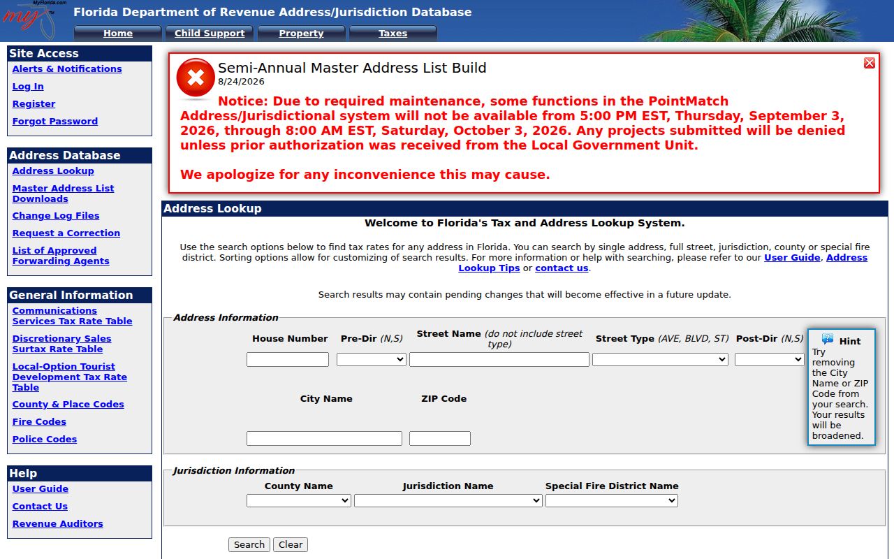
These address fields help confirm the county route before a reader relies on an assessor or Clerk result.
Florida Property Appraiser Search
Every county has its own Property Appraiser portal. Address and owner-name searches are common, but screen labels, history, maps, and export options vary. The Florida DOR county directory is the route to the correct county, not a single statewide appraiser form. A county search may accept a full situs address, parcel or folio number, owner name, city, ZIP, or tax year. If an exact address fails, try a parcel number or a shortened street name, then confirm the displayed legal description.
| Search Field | Type / Use | What to Check |
|---|---|---|
| Owner name | Optional text field | Partial and exact matching rules vary |
| Property / situs address | Optional text field | Physical parcel location |
| Parcel / folio / PIN | Optional exact key | Best bridge to GIS and deeds |
| ZIP or city | Optional field where supported | Not offered uniformly; PointMatch accepts both |
| Tax year | Optional selection | Current and prior years differ |
| Exemption | Filter or displayed flag | Classification clue, not a household roster |
The card can display an owner, mailing address, site address, parcel identifier, legal description, values, exemption fields, land or building detail, and local sale history. Some fields are links or map features rather than search inputs. The owner's mailing address may point elsewhere and can belong to a representative or organization.
Florida Parcel Records and GIS
A parcel card and a map answer different parts of the street question. Florida DOR's NAL file means Name-Address-Legal, SDF is sales data, and NAP means Name-Address-Property. A parcel ID can join a county parcel shape to current tax attributes. The statewide data helps compare jurisdictions and years; a county viewer is still the practical place to click a parcel and open the local property page.
County GIS controls commonly include address or parcel search, a map extent, parcel layers, aerial imagery, zoning, flood areas, municipal lines, school or fire districts, and an identify tool. Layer sets differ. A buffer or radius tool may be absent, so do not assume a map can select every parcel within a fixed distance. Pan along the street, identify each visible parcel, and save the parcel IDs before following individual records.
The Florida DOR data page describes its NAL, SDF, NAP, and reviewed GIS files.
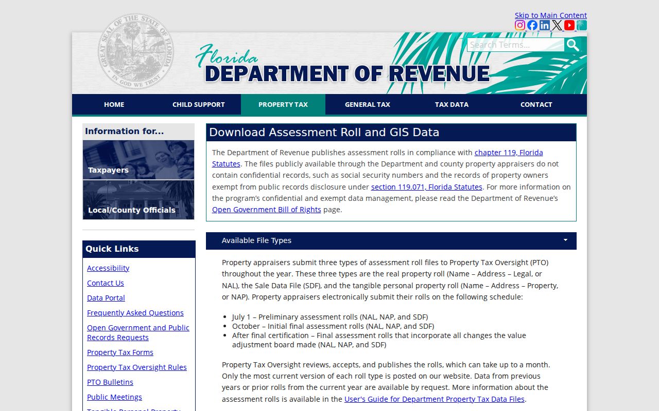
The statewide parcel files supply a backstop when county map tools differ, while a parcel boundary remains an informational map feature rather than a legal survey.
| Parcel Card Field | What It Can Show |
|---|---|
| Owner / name | Individual, trust, company, or other assessed owner |
| Situs and mailing addresses | Physical site and tax-mail destination, which can differ |
| Parcel ID and legal description | Join key and lot, block, subdivision, or metes-and-bounds text |
| Values and exemption | Just, assessed, taxable, and classification information |
| Sales, sketch, or GIS link | County-specific transfer or map context |
Florida Address Terms That Matter
Property systems use labels that look alike but answer different questions. Keep them distinct when a parcel result is compared with a tax roll, map, or recorded deed. A paper plat can preserve the subdivision layout even after a road name changes, while an owner mailing address may have no link to the physical site.
- Parcel
- A defined piece of land identified in assessment and map records, often by a parcel number.
- Situs address
- The physical location assigned to the parcel, as opposed to the address where tax mail is sent.
- Plat
- A recorded map that lays out lots, blocks, streets, and subdivision lines.
- Criss-cross directory
- A printed directory arranged so a street address can lead to a name for that edition year.
When a street number or municipal label changes, search the lot and block, subdivision, or metes-and-bounds text shown in the legal description. Those details can persist across an address change. If a map layer is unclear, ask the Property Appraiser or GIS custodian what its lines represent before treating them as a property boundary.
Florida Deeds Follow Legal Descriptions
To move backward from the current owner, start with the appraiser card's owner name and legal description. Search the Clerk's official-records index for that owner as grantee in the likely acquisition period. In a deed, the grantor conveys and the grantee receives. Copy the party names, record date, book and page or instrument number, legal description, instrument type, and any related document reference before following the prior transfer.
Then search the prior owner as grantee in an earlier period. Repeat in both name directions if a trust, company, estate, spouse, or spelling variant appears. If the street string no longer matches, use the legal description or a recorded plat. A gap can also lead to a mortgage assignment, satisfaction, probate file, tax deed, or court case. These links help trace a recorded chain, but an index hit does not establish who occupied the parcel.
Florida law requires the current online index to reach back to at least January 1, 1990; a county can offer older years. The statewide MyFloridaCounty official-records search routes to local systems. When an image is not online, contact the county Clerk by phone, mail, email, or in person and ask about public terminals, deed books, microfilm, and copy ordering.
Ordinary copies may carry a per-page charge and certified copies can cost more; request an estimate for extensive search or copy work. Older records may be held on microfilm or at the State Archives, and exact years vary by county.
Florida Tax Rolls and Occupancy
Assessment data can provide evidence about an owner and a property, but it does not name every person at the address. A mailing address may belong to a tax representative, attorney, trust, or company, and it may be outside the parcel's county or state. The situs address is the parcel's physical location. The two should not be treated as interchangeable residence fields.
Homestead exemption is an assessment and exemption indicator that can be consistent with owner occupancy. It is not direct proof that the owner lives there now. Other exemptions and confidentiality rules also affect what appears on a public card. DOR's published assessment and GIS files omit confidential or exempt owner records, and prior-year tax-roll data can require a request. A missing name therefore does not show that an address has no owner or household connection.
For tax bills, payments, delinquencies, certificates, and refunds, the Tax Collector is a separate custodian. The Clerk handles the tax-deed sale process, while the Value Adjustment Board is the route for certain assessment, classification, and exemption appeals. Keep these roles separate when interpreting an address result.
Florida Permits Show Dated Work
Building permits and code cases may add a dated record tied to a Florida address. Each city or county runs its own process; there is no single statewide permit screen with uniform fields. Some portals accept a street number and name, parcel or folio, permit number, work type, date range, or status. Others ask the public-records custodian to locate the file. Search a full situs address first, then try the parcel number or a shorter street name if the form rejects the first version.
A permit can identify an application, contractor, work description, issue date, final date, and status. A code case may show a complaint date, violation type, case state, inspector, and property address. These entries document a filing or inspection. An applicant or contractor is not proof of residence, and any complainant field may be restricted. Building histories are useful for dating a change to a structure, but they do not fill in a household list.
When the local portal is absent or incomplete, contact the city or county building department and make a Chapter 119 public-records request for the address and date span. If the address is unincorporated, use the county office rather than a city clerk.
Florida Voter Lookup Is Individual
The Florida Voter Information Lookup requires a first name, last name, birth date, and acknowledgment. It confirms one person's registration and party status; it does not take a street name and return a complete block. New registration or update information can take one to two business days to appear after a county Supervisor processes it. If the result is missing or stale, contact the Supervisor for the county on the record.
Public voter fields can include name, address, birth date, party, phone, email, county, precinct, voting districts, and official voting history. Florida Statute §97.0585 protects the place where someone registered or updated a record, sensitive ID numbers, preregistered 16- and 17-year-old information, and copied signatures. The Address Confidentiality Program gives qualified victims a substitute mailing address; other protected voters can also request withholding. Absence from an online result should not be read as proof that a person does not live in the area.
The individual Florida Voter Information Lookup is free. A full voter extract is a separate monthly request from the Division of Elections or a county Supervisor; it is not an instant public street-browse tool.
Older Florida Street Guides
Historical city directories can pair a name with an address in a particular edition year. The Florida State Library collection is arranged by city and then year, spans from the early 1900s to the present, and is used on-site. Florida Memory's Tallahassee example includes a reverse street guide, where a street address can point to a household entry for the edition. Local public libraries may add yearbooks, newspapers, phone books, cemetery records, and local obituary indexes.
A printed guide is not a current resident roll. Compare the address listing with the alphabetical name entry, since a directory may mark a spouse, occupation, or household role in a separate part of the volume. A missing address can reflect a new subdivision or a year before the house appeared, not necessarily an indexing error. The Florida City Directory collection page explains how to locate editions and read their entries.
Limits of Florida Street Records
No public source is a complete roster of people at an address. Property rolls list assessed owners; voter search confirms one registrant; directories cover the names included in a particular year. Household members who do not appear in those records remain outside the public chain. Utility customer lists and delivery records are not public household indexes, and federal law limits access to personal information from motor-vehicle records.
Use the records for lawful personal research, family history, civic questions, or property curiosity. Florida's public-records law has specific exemptions, and the Division of Elections can withhold protected voter information. A record may be removed from an online view or redacted while the underlying file remains with its custodian.
Lawful use. Florida street and address records are for lawful personal research. Florida law treats stalking as a crime and addresses harassment, including repeated unwanted contact, threats, or surveillance. Do not use an address record to threaten or intimidate anyone.